
DRONE MAPPING
DRONE SURVEYS OF THE TERRITORY
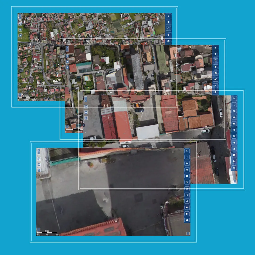
Infrastructure planning requires a detailed and up-to-date topographical survey as a starting point. Mapping open areas, buildings or points that are difficult to reach by foot is often complicated and very expensive.
The accuracy and detail of the data collected is also crucial for good design.

DRONE SURVEYS ALLOW AREAS THAT ARE DIFFICULT OR DANGEROUS TO REACH TO BE MAPPED IN A SHORT TIME, COVERING VAST GEOGRAPHICAL AREAS.
Eagleprojects uses drones with high-resolution cameras and state-of-the-art 3D scanners for topographic surveying. Our fly tech fleet is equipped with a lidar laser scanner, a video camera, and a thermal imaging camera to perform 2D and 3D scans of the most difficult spots. The drones can work at different heights, performing both aerial shots of large areas and detailed surveys down to 1cm/px. Eagleprojects offers a complete service, handling every phase of the survey and oversees projects in close contact with ENAV and D-Flight.
Let's evaluate together the most suitable solution for your needs
QUICK MAPPING
Land mapping using drones is up to 90% faster than traditional methods.
REDUCE DESIGN TIME
Take measurements on your PC directly from the office with a 3D model of the area that is always available.
FROM A TO Z
The service encompasses all stages of the survey: from flight planning to permits, and the processing of the collected data.
MAPPING OF INACCESSIBLE AREAS

Topographical, architectural (roofs and facades) and infrastructural survey can also be made of impassable areas.
ACCURATE INFORMATION

With high resolution the accuracy of the data, in terms of georeferencing, is guaranteed.
FLEXIBILITY

Once the area has been identified, Eagleprojects' technicians will choose the drone model and technology best suited to the requirements.
FIELDS OF EMPLOYMENT

Telecommunications

Energy
Water

Construction
Let's evaluate together the most suitable solution for your needs